Precision Weather Information Production Technology
Currently, commonly used weather information provides information on a wide range of areas with a horizontal resolution of 5km or 1.5km, so there is a limit to understanding local phenomena in various fields that require weather information from meters to hundreds of meters. To solve these problems, DIGIQUAY has developed ultra-high resolution precision weather information production technology tailored to consumers and is using it for local issues in various fields.
Weather information based on numerical models produced by the Korea Meteorological Administration is information produced for wide-area weather forecasts for the general public
Limitations and low utilization of various social issues requiring high-resolution weather information of 0m to 999m Requires customized ultra-high resolution weather information service
DIGIQUAY Precision Weather Information Production Technology
Differentiation of Super-Resolution Precision Meteorological Information Production Technology
CAMMIF
Customized precision weather information heterogeneous model linkage technology Custom Advanced Meteological Model InterFace Program
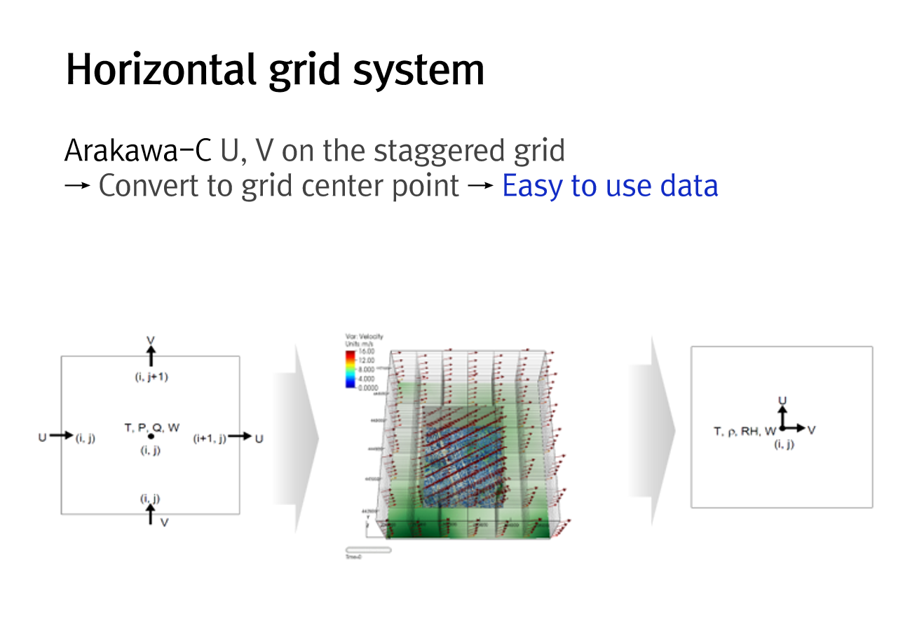
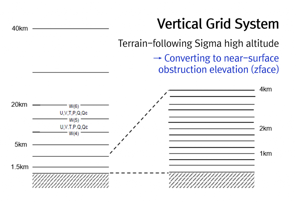
Map mapping and horizontal and vertical grid system conversion technology considering local characteristics → Direct input into various application models (environment, agriculture, energy, etc.) through customized weather information production
Direct input and output of parameters for application models Temperature, humidity, wind, precipitation, air stability, mixed altitude, planetary boundary elevation, etc
Production of super-high-resolution (100m) weather information using domain overlap techniques based on the highest resolution weather forecast data (LDAPS, 1.5km) produced by the Korea Meteorological Administration, rather than simple interpolation or objective analysis performed by the existing diagnostic model
Calculation of precise weather and climate information by directly and in real time inputting ultra-high-resolution weather information reflecting the dynamics and physical processes of micro-scale weather data through the development of horizontal and vertical conversion modules
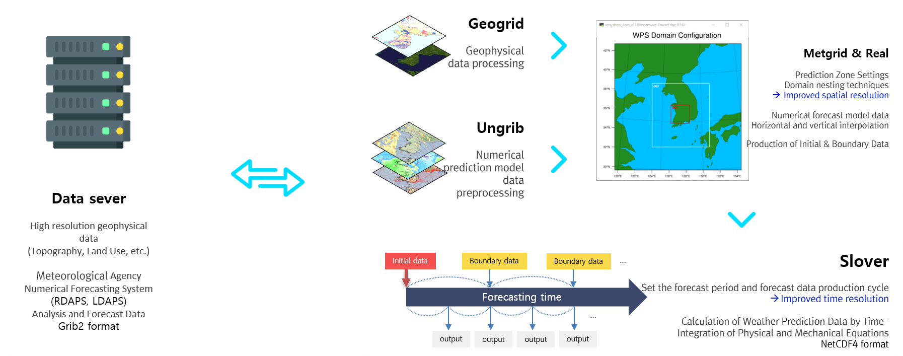
WRF
Customized Precision Weather Information Numerical Model Technology Weather Research and Forecasting Model
A customized micro-scale weather forecasting information production system that reflects weather dynamics and physical processes in 100 meters
– High-resolution topography and land utilization data and local forecast data of the Korea Meteorological Administration (1.5km) are used as input data
– Accurate weather forecasting data can be calculated by improving time and spatial resolution
Example of customized precise weather information input topographic data
Topographic Information of Weather Numerical Model by Resolution
Land Use Information of Weather Numerical Model by Resolution
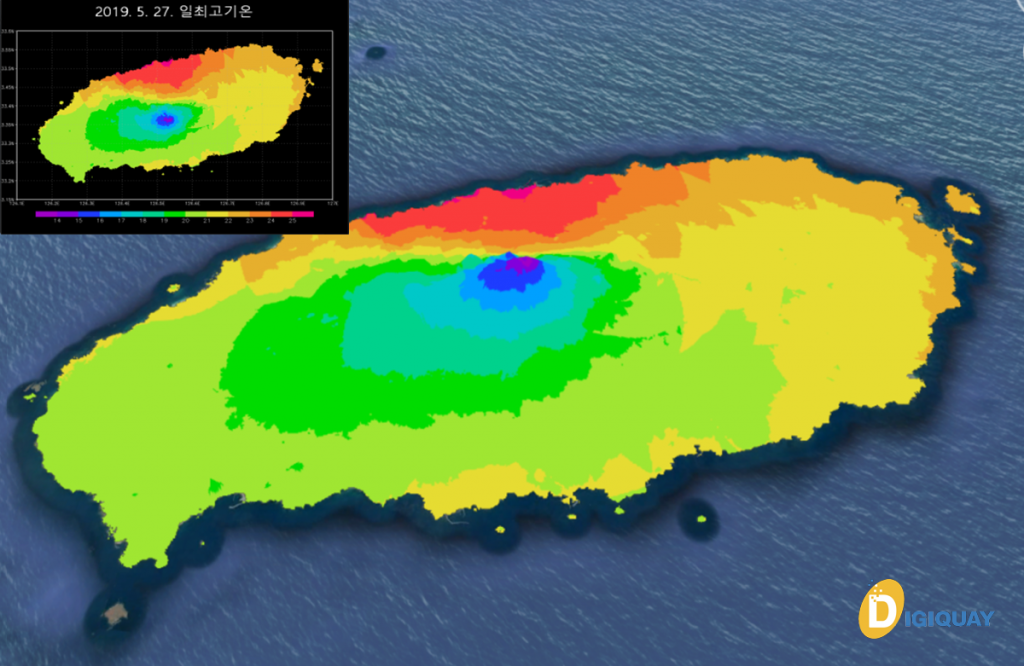
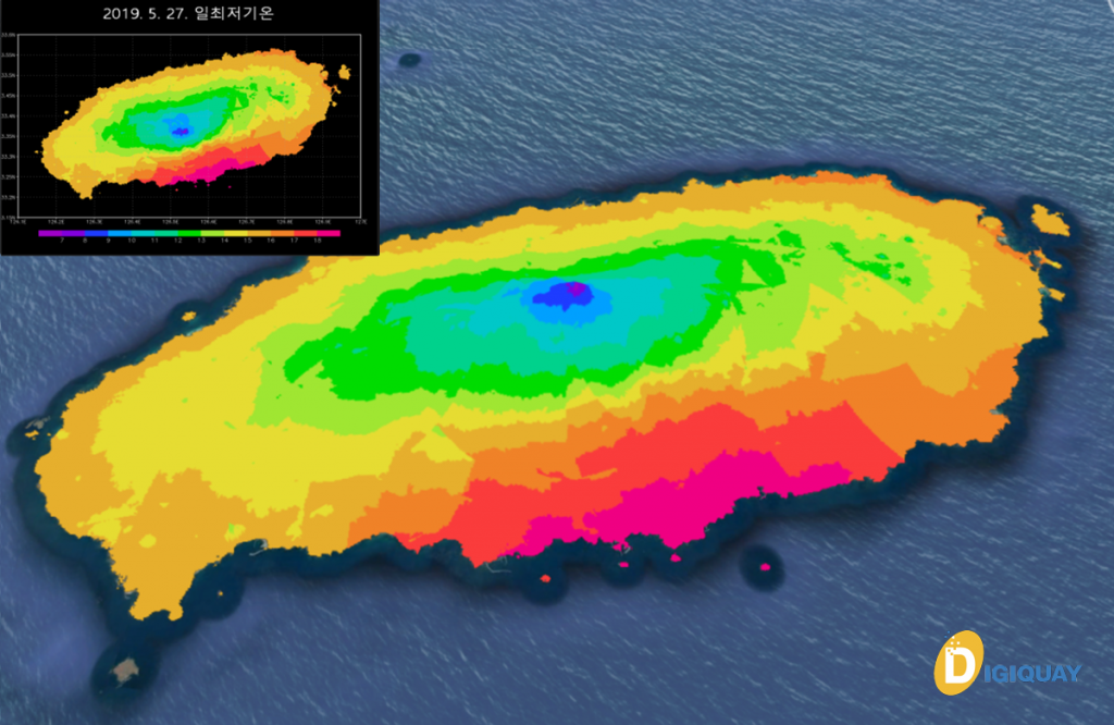
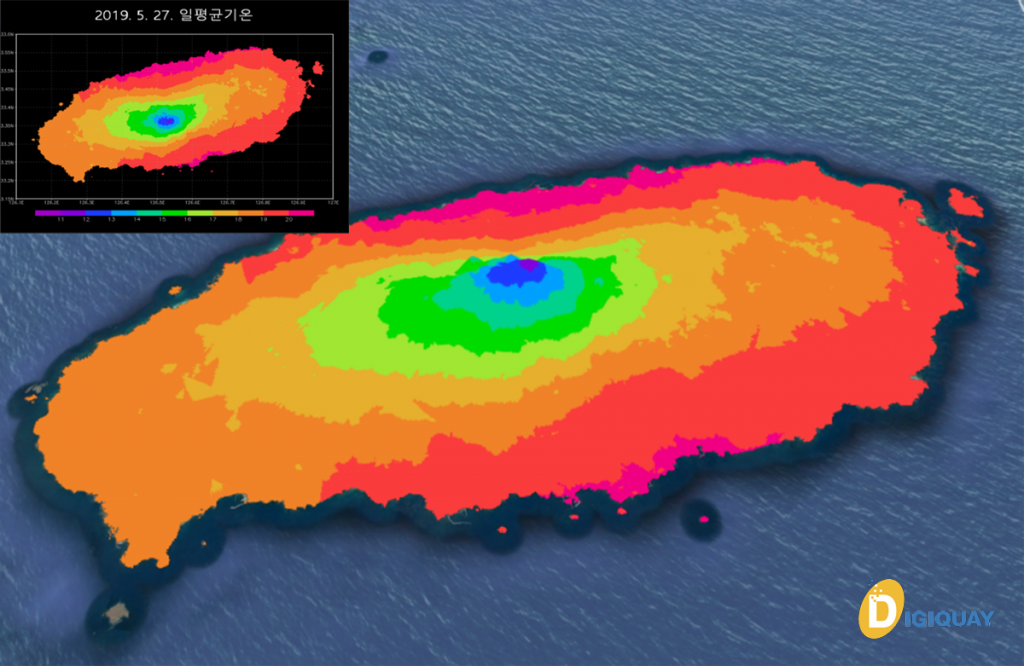
Example of precision weather information visualization calculation
30m*30m*2m Example of Jeju Island production
20190527 daily maximum temperature
20190527 the lowest daily temperature
20190527 the average daily temperature
Previous
Next
Production of Precision Agricultural Weather Forecast Information
– In 2018, the Electronics and Telecommunications Research Institute (ETRI) carried out the production of precision weather prediction information and the development of three-dimensional visualization technology to optimize the defect rate of the precision industry according to the concentration of fine dust
– This technology has been applied to the production of microclimate prediction information in Chuncheon City in a study on microclimate analysis and wind road security to alleviate urban heat island phenomenon in Chuncheon City since December 2019
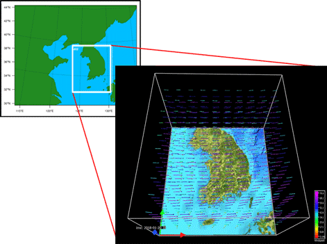
3D visualization of weather information
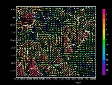
Chuncheon City 2D Precision Weather Information (Windfield)