Fire Suppression Solutions
Forest fire response monitoring/analysis solution
MEDS
산불확산 진단·예측 솔루션
Mobile Extinguish-Drone System
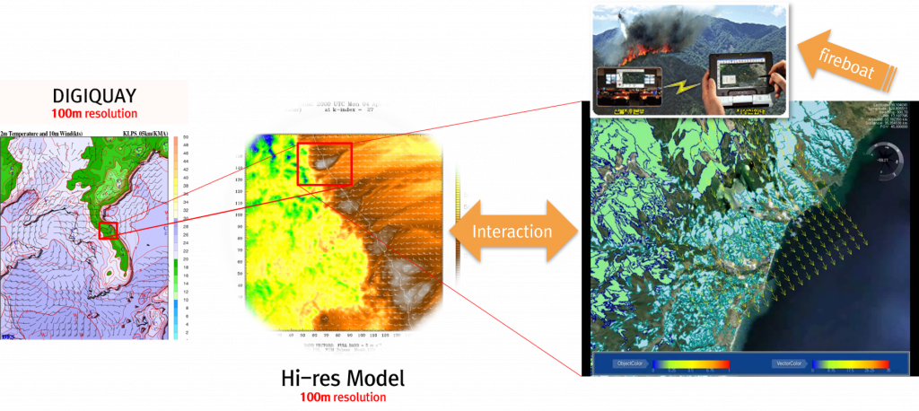
Using ultra-high-resolution wildfire spread diagnosis and prediction information, MEDS quickly detects the direction of the spread of embers through numerical modeling and drone observation on the lower side of the wind, and identifies the direction of prediction.
DIGIQUAY’s drone, equipped with eco-friendly fire extinguishing bombs, can be combined with DIGIQAUY numerical modeling technology to diagnose and predict the direction of forest fire spreading in forest fire areas.
The MEDS solution utilizes ultra-high-resolution precise weather information and monitoring technology to provide accurate forest fire progress information, which enables drones to move to the appropriate location for quick and accurate containment. The system also provides drone-monitored weather information, as well as topographic information in areas where wildfires have occurred, at ultra-high resolution to help with accurate containment.
Forest fire spread diagnosis and prediction solution (example)
Ultra-high resolution precision weather information, drone observation, numerical modeling, and eco-friendly non-fire extinguishing coal (in manufacture) bonding solution

